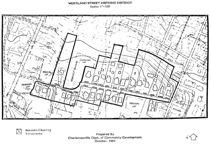
 Wertland Street Historic District
Historically significant CBS Rentals houses in this district include: 1200 Wertland, 1206 Wertland, 1212 Wertland, 1250 Wertland, 1252 Wertland, 1254 Wertland, 1256 Wertland, 1306 Wertland, 1310 Wertland.
"The Wertland Street Historic District is significant because of its historic and architectural associations with both Charlottesville and the University of Virginia. Beginning with the 1830 construction of the Wertenbaker House, home of the University's second librarian, through current times as a residential area for faculty and students, the development of Wertland Street has closely paralleled the growth of the University. Containing the most undisturbed and cohesive collection of Victorian vernacular design houses left in Charlottesville, the district has remained relatively unchanged for seventy years, avoiding the forces of change that have altered the area surrounding it and many of the other neighborhoods surrounding the University of Virginia. While the recently listed Rugby Road-University Corner Historic District includes many significant buildings that reflect the history of the University over more than a 100 year period, nowhere else in Charlottesville is the history and architecture of turn-of-the-century Charlottesville as well preserved and self-contained as in the Wertland Street Historic District."
~ From the Wertland Street Historic District National Register Nomination Form
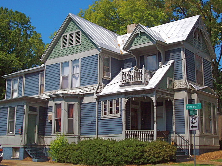 201 14th Street (King-Runkle House)
Historically significant CBS Rentals houses in this district include: 1515 Virginia Avenue, 1522 Virginia Avenue, 420 15th Street, 428 15th Street, 432 15th Street, 503 15th Street, 422 17th Street, 200 14th Street, 201 14th Street, 203 14th Street, 206 14th Street, 214 14th Street, 217 14th Street, 320 14th Street, 327 14th Street.
"Comprising an eighty-four-acre area north of Thomas Jefferson's original "academical village" at the University of Virginia, the Rugby Road-University Corner neighborhood contains a broad range of commercial, residential, and institutional structures mirroring the university's development between the 1890s and the Great Depression. Three-quarters of the buildings within the District's bounds exhibit one or more of the various revival styles popular in the late 19th and early 20th centuries.
The District boundaries are by and large determined by obvious man-made or geographic features. University Avenue, which skirts the northern edge of the original campus, forms the District's southern boundary. West of Rugby Road and Carr's Hill the land slopes precipitously toward Emmett Street (U.S. 29), a major commercial corridor. The District encompasses all of Carr's Hill, together with its university buildings and fraternity houses. The District's western boundary is coterminous with Culbreth Road, which wraps around the base of Carr's Hill, returning east to Rugby Road. Then, crossing the Chesapeake and Ohio Railroad tracks at Beta Bridge, the District line turns north and west to encircle Lambeth Stadium, including what remains of its former playing field. The line then continues northwest, wrapping around University Circle, a handsome residential street occupying a ridge of land rimmed with trees that shield it from the modern commercial sector at the base of the hill to the west. Following the rear lot lines of the houses on University Circle, the District boundary crosses Rugby Road and jogs north, following the back property lines of Preston Court, a residential circle containing several fraternity and sorority houses. Continuing south, the District line follows Cabell Avenue and then jogs east to take in the late 19th-century dwellings facing 15th Street. The boundary next turns west to include all lots facing Virginia Avenue, site of several early fraternities and former student boarding houses. The boundary's final stretch veers southeast along the railroad tracks until reaching the C & 0 overpass, which marks the eastern edge of the Corner."
~ From the Rugby Road-University Corner Historic District National Register Nomination Form
| Equal Housing Opportunity |